Before the County Line: How Regional Boundaries Took Shape
Learn how regional boundaries took shape by comparing maps, terrain, and records to distinguish surveyed lines from features that follow the land.
How can you tell whether a county line follows the land or simply crosses it? To understand how regional boundaries took shape, compare the line with the terrain and with maps made at different times. A bend at a creek may have one history; a straight segment added later may have another.
Choose a boundary
Pick a boundary small enough to inspect closely: a county edge, a provincial border, or the division between two named regions. Find a current map showing roads, waterways, elevation, and settlements. Then look for an older map from a library, local archive, or government map collection.
Keep the question narrow. You are not trying to recover every change in a region’s history. Note the boundary’s endpoints and where it passes near a river, ridge, road, town, or open plain. Check the map title, legend, date, and issuing agency so you know what kind of boundary it claims to show.
A boundary can be administrative without being arbitrary. Officials may have chosen a line for convenience while using a river crossing, travel route, or older settlement as a reference. Conversely, a natural feature does not automatically make a boundary socially or politically meaningful.
Read the land
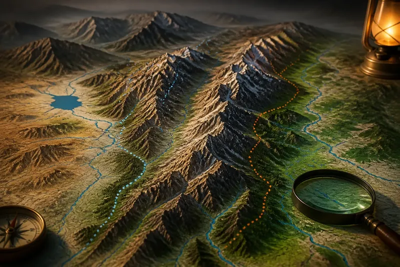
Trace the line against the terrain before searching for a historical explanation. Does it follow a ridge crest, shoreline, watershed, or stretch of difficult ground? Or does it cut across slopes and streams? A physical feature may have offered a visible reference, but the map alone cannot tell you who chose it or why.
Pay special attention to turns and changes in character. A boundary that follows a creek and then leaves it for a ruler-straight segment may combine more than one kind of decision. A turn at a confluence, pass, or narrow neck of land may point to a recognizable landmark. Straightness can suggest surveying or a paper-defined extension, but it is a clue, not a verdict.
Check how people move through the area. A line crossing a road or settled valley may divide communities that interact regularly. A line through sparsely settled terrain may have been easier to draw there, though that does not mean the land was unused. Treat roads and settlement patterns as context, not proof of origin.
Compare old maps
Compare the boundary’s shape on older and current maps rather than expecting exact alignment. Mapmakers use different scales and conventions, and older maps may simplify coastlines or omit small streams. Look for a line that persists, shifts, or disappears while the settlements and terrain remain.
Record what changed. Did a county edge move while a river stayed put? Did a named district appear before a formal administrative line? These differences can help distinguish a lasting physical feature from a boundary that officials created, revised, or abolished.
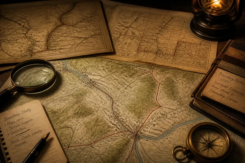
Say you are studying a fictional county edge near the invented villages of Alder Ford and Mill Crossing. A county atlas dated 1880 shows the line following a creek between the villages, then ending at a marked stone on the creek’s north bank; a government boundary description from that year also names the creek and stone. A later county map, dated 1910, continues the line west from that stone as a straight segment across farmland, while the creek remains in place. You check the county board’s recorded boundary order for the later map’s period and find that it describes a surveyed extension from the stone to a township corner. The sequence supports a specific account: the older portion used the creek and stone as references, and the straight segment came from a later surveyed extension. If the order gives no reason for the extension, that motive remains unknown; the maps and record establish the sequence, not why officials preferred it.
Ask what the line did
Boundaries have served different purposes at different times. Governments may divide territory to organize courts, taxation, land records, elections, or public services. Communities may recognize a region through shared trade, speech, worship, or travel even when no official line marks its edge. A boundary can also reflect a negotiated claim to land or authority.
Identify the institution behind the line. A county boundary, school district, watershed, and cultural region can overlap without sharing the same limits. Check the map’s title, legend, and issuing agency before calling a line a county edge or regional border.
Then look for present-day consequences. Are records or services organized by one side and the other? Do roads connect across the line, or do routes lead toward different centers? These observations show how a division functions now, not necessarily why it was originally drawn.
Follow the names
Place names can preserve traces of older divisions. A village may retain the name of a former district, estate, or community even after it becomes part of a different administrative unit. Search for repeated names on both sides of the line and names used locally but absent from official maps.
Treat names as clues to investigate, not as a hidden map that explains itself. A shared name might reflect a common landscape or a later naming choice; a change in names might follow language, settlement, or administrative practice. Local histories, archival catalogues, and gazetteers can help establish when a name was recorded.
Where do the clues lead?
Does a river make a natural boundary?
It can provide a visible edge, but rivers shift, branch, and flood, while communities may use both banks. Check whether the mapped boundary follows the water consistently and whether older maps place it in the same channel.
Why do some boundaries run straight?
A straight line may reflect surveying, negotiation, or an administrative choice made on paper. Compare its endpoints and first appearance on dated maps before inferring a cause.
Can a cultural region have an official edge?
An agency may define a region for a specific purpose, but its limits may not be universally accepted. Find out who drew the line and what the definition is meant to organize.
What if old maps disagree?
Record the disagreement instead of forcing the maps into one story. Differences in scale, mapmaking conventions, or the boundary’s history may matter; an archive can help identify a map’s source and purpose.
Separate evidence from inference
Sort your notes into three groups: what the maps show, what the landscape suggests, and what remains uncertain. “The line follows the ridge on this map” is an observation. “Officials chose it because the ridge was easy to recognize” is an interpretation that needs documentary support.
- If the line follows a stream on both an old map and a current one, check whether a legal description names that stream; if it does, report the feature as a documented reference, and if it does not, describe the map evidence without claiming official intent.
- If a straight segment appears on a later map, check its endpoints against a boundary order or survey record; if the record describes the segment, give that sequence, and if no record is available, call surveying a possibility rather than a confirmed cause.
- If two maps place the line differently, compare their dates, scales, and issuing agencies; if one is an unofficial regional map, use the authoritative boundary source for the administrative limit, and if the sources serve different purposes, explain that distinction.
- If a road crosses the boundary and joins nearby settlements, check whether records or services are organized by jurisdiction; if they are, describe that present-day division, and if not, avoid assuming the line separates everyday community life.
- If a place name appears on only one side of the boundary, check a gazetteer or local history for its date and usage; if it refers to an earlier district, note that history, and if its origin is unclear, leave the explanation open.
- If a creek, ridge, or other feature no longer matches the mapped line, compare older maps and descriptions; if they document a shift or replacement reference, explain the change, and if they do not, distinguish the visible mismatch from any proposed cause.
For a stronger account, consult county histories, public records, legislative descriptions, or archival map notes where available. A boundary description may name a creek or survey marker; a government record may state an administrative purpose. If sources do not explain the choice, say so plainly.
Tracing every bend on a small-scale map is not worth the effort, nor is assigning a motive to each turn. Focus on places where the line changes character: where a physical feature gives way to a straight segment, where an old boundary vanishes, or where a settlement straddles the division.
Reading how regional boundaries took shape means treating a line as evidence of decisions, comparing it with the ground, and distinguishing administrative limits from physical features. When the record remains incomplete, state exactly what the map and documents establish—and leave the unanswered motive unanswered.