The Mountain Range That Looks Like One Wall
Mountain range map reading helps reveal how peaks, ridges, and gaps shape a region, so you can tell a true crossing from a misleading opening.
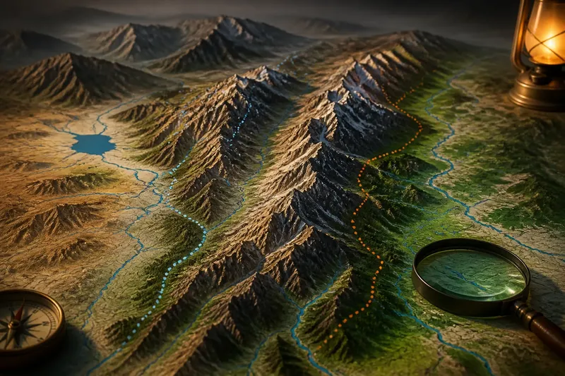
Where does a mountain range actually end, and where can a place on one side connect with the other? Mountain range map reading starts with more than a dark band of high ground: the shape of the range depends on its structure, its flanks, and the landscape around it.
Read the whole landform
A mountain range is not simply a line of peaks. It is a region of elevated terrain whose ridges may branch, overlap, or run in parallel. Between them, plateaus and basins can create distinct areas that a small-scale map compresses into one broad mass.
Begin by comparing the range with neighboring landforms. A plateau can sit high without having the sharp crest of a ridge; a basin may be enclosed by several ridges; and foothills can spread the transition into a wide belt. These relationships explain why a range may look like a clean boundary on a regional map but blur into surrounding uplands on a more detailed one.
Notice the range’s shape
Look at the overall pattern rather than searching for a single opening. A long, narrow range may form a conspicuous divide between regions. A broad mountain belt with branching ridges may contain several distinct highland areas and no single crest that defines the whole system.
Map shading can make these patterns easier to see, but the direction of light and choice of colors affect the impression. Compare shaded relief with a physical map or contours, and notice whether the high ground forms one spine, several parallel ridges, or a broad plateau. A change in map scale can also alter what seems to be one continuous feature.
Understand the divide
Many mountain regions separate drainage basins. Rain falling on opposite sides of a drainage divide flows toward different river systems, so the divide may help explain regional connections and boundaries. It does not always follow the highest visible crest: local topography can send water in unexpected directions.
On a physical map, trace major rivers away from the highlands and note where their drainage areas meet. A divide describes the direction water flows, not an absolute barrier to people, roads, or wildlife. A road may cross a divide, while a river may run along one side of a range before turning through a separate lowland.
Compare names and borders
Mountain names and administrative borders often describe different things. A named range may have locally recognized limits that are not marked by a state or county boundary, while a political border may cross a mountain region without following its main crest.
Check the map legend and source before treating a line as a physical boundary. A shaded edge may represent a named region, a national park, a watershed, or an administrative area. The line’s meaning matters: each answers a different question about how the landscape is organized.
Questions about mountain maps?
Does a mountain range always follow one ridge?
No. Some ranges form a clear spine, while others comprise several parallel ridges, plateaus, and enclosed basins. The map scale and the definition used for the range can change how its outline appears.
Is a drainage divide the same as a mountain crest?
Not necessarily. A drainage divide separates areas whose water flows into different river systems, and it may run near a crest without matching the highest points throughout.
Why do mountain-range boundaries vary between maps?
Maps may use different naming conventions, scales, or purposes to define a range. One map might emphasize a landform, while another shows a park or administrative boundary instead.
Can a mountain range be a regional boundary?
It can influence how regions are separated, but it does not automatically determine a political or cultural boundary. People, roads, rivers, and local histories can connect places across high ground.
Work through one map
Imagine a regional map showing a broad shaded band between a western basin and an eastern plain. Start with the legend: it identifies the band as a named mountain region, not a border. Next, compare its shading with contours; they show several ridges and a high interior plateau rather than one continuous crest. Then trace the rivers: streams on the west drain toward one basin, while those on the east flow to another. The resulting reading is specific: the mountain belt separates major drainage areas, but its regional outline is broader than any single ridge, and the map does not establish a political boundary.
Keep the map in scope
It is not worth trying to infer a region’s cultural identity or political limits from relief shading alone. A physical map can show elevation patterns and drainage, but names, borders, and connections require the relevant thematic map and its legend.
For mountain range map reading, keep three questions distinct: what landform is shown, where water divides, and which boundary the map actually marks. That separation makes the high ground easier to interpret without turning every ridge into a wall between places.